Which Portland neighborhoods are most friendly
for walking, biking, and transit?
PDX Viz
is pretty straight foward. Set time ranges for your favorite
transportation modes to reach points of
interest (downtown, local grocers, neighborhood schools). The individual
homes that fit your criteria
will light up on the map. Mouse over a home to see the address.
A word of warning, PDX Viz loads a lot of data and uses WebGL. So a snappy
connection, a decent PC,
and a modern browser are recommended. Little to no testing has been done
for mobile, sorry!
A few examples...
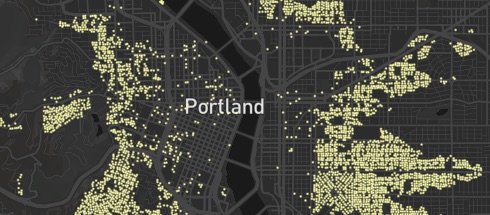
Within 25 min of Pioneer Square by public transit
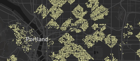
Within a 10 min walk to the nearest grocer
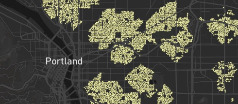
Within 10 min cycle to schools (all levels) and nearest grocer
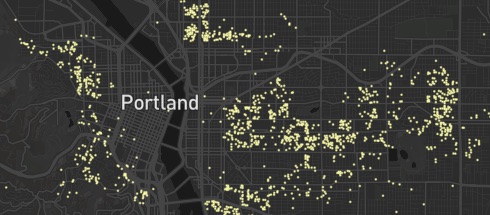
Homes built between 1880 and 1900
How does it work?
PDX Viz takes data about homes, grocers, and public schools from Portland Map's Open Data and connects it to trip times found with OpenTripPlanner. When necessary the times are approximated with natural neighbor interpolation. All this data is loaded into your browser with Papa Parse, and finally it's plotted with the very nice MapBox GL.
Caveats
The trip times don't take into account traffic. This is a big deal for public transit routes that rely on the bus. So the PDX Viz maps will be a bit (or a lot) optimistic.
Also, the trip data was collected in August 2016. If TriMet has more recent route changes (or perhaps a fancy new bike share system), they won't be reflected here.